
 Apple TV + F1")


Venezuela Earthquake Shakes Coastline Raising Concerns Across the Region – Is There a Tsunami Threat to Caribbean or U.S. East Coast?
-
Blogs, Travel
-
-
4 mins
-
Travel and Tour World
-
Namrata Sinha
-


Venezuela earthquake strikes; no tsunami threat to the U.S. East Coast, Caribbean, or Bahamas. Official updates from USGS and Tsunami Warning Center.
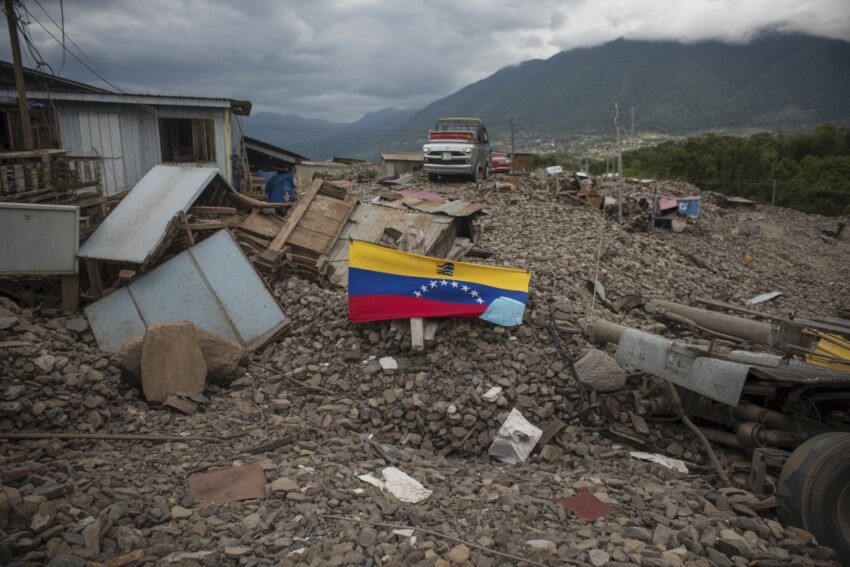
On November 18, a strong Venezuela earthquake shook the region off the coast of Yaguaraparo, Venezuela. With a magnitude of 5.0, the earthquake struck at a depth of 123 km. Despite the tremor’s intensity, both the United States Geological Survey (USGS) and the Tsunami Warning Center have confirmed there is no tsunami threat to the Caribbean, the Bahamas, or the U.S. East Coast. Here’s a breakdown of the situation, based on the latest official updates.
What Happened During the Venezuela Earthquake?
At 8:38 PM ET, the Venezuela earthquake struck outside Yaguaraparo, off the northern coast of Venezuela. The USGS confirmed the earthquake’s magnitude of 5.0, with a considerable depth of 123 km. This earthquake is part of the ongoing seismic activity in the region, caused by the interaction between the Caribbean and South American tectonic plates.
Although this earthquake was substantial, there has been no official warning of any tsunami threat. The National Weather Service’s Pacific Tsunami Warning Center, which monitors the Caribbean region, has issued no alerts regarding potential tsunami waves following the earthquake.
Why No Tsunami Threat?
The lack of a tsunami threat following the Venezuela earthquake can be attributed to several factors. Tsunamis are usually triggered by seismic activity that displaces a significant amount of water, particularly in shallow areas. However, this earthquake’s characteristics, such as its depth and the lack of significant seafloor displacement, do not meet the criteria for tsunami formation.
The Pacific Tsunami Warning Center has confirmed that there is no risk to the U.S. East Coast or Caribbean islands. Using advanced monitoring tools like seismic sensors and the Deep-ocean Assessment and Reporting of Tsunamis (DART) system, the center continues to monitor the region, ensuring the public is informed if a tsunami threat were to arise.
The Seismic Landscape of Northern Venezuela
Northern Venezuela sits on a complex network of fault zones where the Caribbean and South American tectonic plates meet. This interaction has made the region prone to seismic events. The Boconó and El Pilar faults are among the most significant fault zones in Venezuela, and their movements have caused numerous earthquakes in the past.
- Historical Earthquakes:
- The devastating 1812 earthquake caused massive destruction in cities like Caracas and Mérida.
- A major earthquake in 1967 also hit the northern coast, causing significant damage.
These past events show the seismic vulnerability of the region. While the Venezuela earthquake is the latest in a series of tremors, no tsunami threat has been detected, which is a relief for those in the affected regions.
Monitoring Agencies Respond to the Venezuela Earthquake
Both the USGS and the University of the West Indies Seismic Research Centre (UWI-SRC) have been closely monitoring seismic activity in the Caribbean. According to the UWI-SRC, earlier seismic events in the region are being reviewed to determine if they are connected to the recent earthquake.
- USGS Response:
- The USGS plays a crucial role in tracking seismic events worldwide, including the Venezuela earthquake. Using a vast network of sensors, the USGS provides real-time earthquake data to ensure that alerts are issued promptly if needed.
- Tsunami Warning Center’s Role:
- The Pacific Tsunami Warning Center, part of NOAA’s Tsunami Program, also tracks seismic events across the Pacific and Atlantic Oceans, including the Caribbean region. Although tsunamis are more common in the Pacific, the center actively monitors areas like the U.S. East Coast and the Caribbean for potential risks.
Thanks to these monitoring efforts, authorities have been able to confirm that there is no tsunami threat in the aftermath of the Venezuela earthquake.
Understanding Tsunami Formation
To understand why no tsunami was generated by the Venezuela earthquake, it’s essential to know how tsunamis form. These large ocean waves are typically triggered by seismic activity or volcanic eruptions under the sea. Tsunami waves travel at very high speeds in deep ocean waters, but their size increases significantly when they reach shallow coastlines.
For a tsunami to form, there needs to be substantial displacement of the seafloor, pushing large volumes of water upward. The Venezuela earthquake did not result in this kind of displacement, which is why no tsunami threat was detected following the event.
Seismic Activity in the Caribbean and U.S. East Coast
The Caribbean region is no stranger to seismic activity, and the Venezuela earthquake is just the latest in a series of tremors that have affected the area. There have been recent earthquakes near Trinidad and Tobago, as well as a larger earthquake near the Colombian border. Despite this ongoing seismic activity, the region has not experienced a major tsunami in recent years.
The USGS earthquake data from the region shows that earthquakes, while frequent, are often followed by no major aftershocks or tsunami threats. Modern monitoring systems from the Tsunami Warning Center, combined with global seismic data, have greatly improved the ability to predict and prevent widespread damage from tsunamis.
Earthquake Preparedness in Seismic Zones
For those living in seismic zones like Venezuela, earthquake preparedness is key. Even though the Venezuela earthquake did not trigger a tsunami, it serves as a reminder of the ongoing risk of seismic events. Here are some preparedness tips for residents:
- Secure Heavy Items: Ensure that large furniture and other heavy objects are anchored to prevent them from toppling during an earthquake.
- Know Evacuation Routes: Have a clear evacuation plan in place and know where to go in case of an earthquake or tsunami.
- Stay Informed: Always listen to official warnings from agencies like the USGS and the Tsunami Warning Center, which can provide up-to-date information during seismic events.
Preparedness is crucial in minimizing risks and ensuring the safety of residents in earthquake-prone areas. While the Venezuela earthquake did not lead to a tsunami, staying informed and prepared for future events is always wise.
Conclusion: Venezuela Earthquake No Tsunami Threat to U.S. East Coast or Caribbean
In conclusion, the Venezuela earthquake has raised concerns due to its magnitude, but official agencies have confirmed there is no tsunami threat. The USGS and Tsunami Warning Center have both reassured the public that there is no immediate risk of tsunami waves following the event. As seismic activity continues in northern Venezuela and the Caribbean, authorities remain vigilant, using advanced monitoring systems to detect and assess potential risks.
Though this earthquake did not generate a tsunami threat, it serves as a reminder of the region’s ongoing seismic activity and the importance of being prepared for future events. By staying informed and following safety guidelines, residents can better protect themselves from the risks associated with earthquakes and other natural disasters.
The post Venezuela Earthquake Shakes Coastline Raising Concerns Across the Region – Is There a Tsunami Threat to Caribbean or U.S. East Coast? appeared first on Travel and Tour World


Comments and Responses
Please login. Only community members can comment.