
 Apple TV + F1")


California Joins Arizona, North Carolina, Montana, and Utah, driving a Booming AI Travel Trend That’s changing the Face of Tourism in the United States of America

-
Blogs, Nature & Wildlife, History & Art, Travel
-
-
8 mins
-
Travel and Tour World
-
Upasana Chatterjee
-


Discover how Artificial Intelligence (AI) is revolutionising landscape and drone photography across the United States of America — from California’s Yosemite National Park to Arizona’s Antelope Canyon — merging technology, creativity, and sustainability in a transformative travel movement that’s reshaping tourism and exploration.
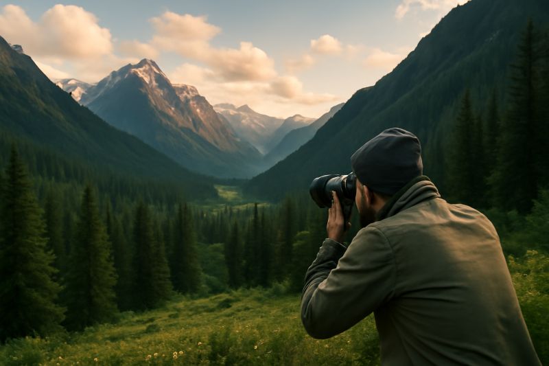
In the vast and breathtaking landscapes of the United States of America, a new kind of expedition is taking shape — one that fuses innovation with imagination, technology with travel, and data with dreams. Across the nation’s sweeping terrains, from the mist-shrouded cliffs of California’s Yosemite National Park to the sun-drenched arches of Utah, and the ancient canyons of Arizona, a quiet revolution is unfolding.
Welcome to the AI Photography Trek USA — a modern odyssey where Artificial Intelligence (AI) becomes not merely a tool, but a companion in creative exploration. Here, the lens meets logic, and nature’s timeless beauty aligns with predictive precision.
This revolution stretches far and wide — from the coastal panoramas of the Pacific Coast Highway in California, to the rugged wilderness of Montana’s Glacier National Park, the geothermal wonders of Wyoming’s Yellowstone, and the sacred red sands of the Navajo Nation in Arizona. Across each state and every border, AI-driven tools are redefining what it means to travel, explore, and experience America’s natural wonders.
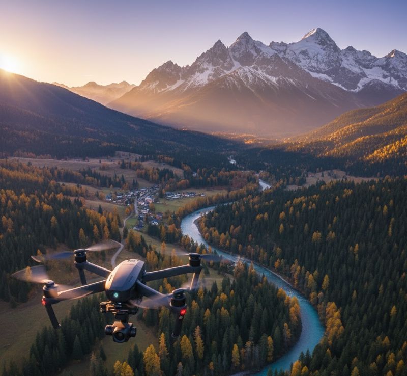
At the heart of this transformation lies AI’s remarkable ability to turn instinct into intelligence. Through complex algorithms, it analyses light patterns, weather systems, and solar trajectories using verified data from authoritative sources such as the National Oceanic and Atmospheric Administration (NOAA) and the Federal Aviation Administration (FAA). With this knowledge, AI can determine the perfect moment to photograph a Grand Teton sunrise, predict the exact second the fog drifts through the Great Smoky Mountains, or even generate drone flight paths that adhere to FAA airspace rules.
Yet, this union of art and automation is governed by a delicate balance — a balance defined by the laws that safeguard America’s national treasures. The National Park Service (NPS), for instance, enforces a strict prohibition on drones within its parks to protect wildlife and ensure visitor tranquillity. Conversely, agencies such as the U.S. Forest Service (USFS) and Bureau of Land Management (BLM) embrace responsible aerial creativity under clear licensing frameworks.
Thus, the AI Photography Trek USA becomes more than an artistic pursuit — it becomes a statement of responsibility, respect, and revolution. It empowers photographers and travellers alike to capture beauty without compromise, blending technology and conservation in one seamless journey.
This is not merely an evolution in how we take photographs — it is a redefinition of how we see. It represents the dawn of an era where human creativity and machine intelligence unite to celebrate, preserve, and immortalise the awe-inspiring spirit of America.
The Strategic Core – Regulation, Feasibility, and Reality
The rise of AI photography treks across the USA marks an exciting chapter in digital tourism. It is technically feasible, logistically complex, and environmentally sensitive, requiring a keen understanding of both technology and territory.
The Federal Aviation Administration (FAA) governs all drone operations nationwide under Part 107 for commercial pilots and TRUST certification for recreational users. Every drone weighing over 0.55 lbs (250g) must be registered, and additional waivers are required for operations beyond visual line of sight, over people, or at night.
The National Park Service (NPS) maintains one of the strictest regulations: an outright ban on drone launches and landings within its park boundaries. This includes world-famous sites such as Yosemite National Park (California), Yellowstone (Wyoming, Montana, Idaho), and Grand Teton National Park (Wyoming). The policy aims to preserve both the ecological balance and the immersive visitor experience that define these treasured landscapes.
However, outside NPS jurisdictions, a new frontier opens. The U.S. Forest Service (USFS) and Bureau of Land Management (BLM) — which manage millions of acres across states like Utah, Colorado, Arizona, and Oregon — allow AI-assisted drone photography under structured permit systems. These frameworks encourage creative innovation while ensuring environmental compliance.
Even more distinct are the tribal lands managed by sovereign authorities such as the Navajo Nation, which governs access and photography within its sacred landmarks — notably Antelope Canyon and Monument Valley. These areas require specific tribal permits, reflecting a vital intersection of cultural preservation and technological curiosity.
Through the integration of NOAA’s environmental data and FAA’s regulatory datasets, AI helps photographers navigate these legal landscapes with precision. It aligns creativity with compliance, transforming the once chaotic planning process into a seamless, ethical workflow.
California: The Heartbeat of AI Photography Innovation
Few places on Earth embody the intersection of technology and natural grandeur quite like California. As both the birthplace of Silicon Valley and home to some of the world’s most photographed landscapes, California is now leading the AI photography revolution.
In Yosemite National Park, drones remain prohibited under NPS policy. But AI offers photographers the next best thing — insight. By leveraging NOAA’s solar data, AI systems simulate the lighting conditions at Glacier Point, Tunnel View, and Half Dome, helping photographers capture Yosemite’s golden granite at its most luminous moment — all without disrupting nature’s peace.
Meanwhile, along the Pacific Coast Highway, AI merges meteorological intelligence with USFS mapping tools to identify the clearest skies, safest launch zones (where drones are permitted), and best times for visibility. From Big Sur’s rugged cliffs to Point Lobos State Reserve’s foggy coves, AI turns unpredictable coastal conditions into photographic opportunities.
The result? Smarter, safer, and more sustainable tourism. By predicting conditions and distributing visitor flows, AI helps reduce congestion at iconic spots while directing tourists to lesser-known areas — boosting local economies and protecting fragile ecosystems.
Wyoming and Montana: Harmony Between Innovation and Preservation
In the wild and untamed territories of Wyoming and Montana, AI plays a more subtle role — that of the silent strategist behind the camera. Both Grand Teton National Park and Yellowstone National Park are governed by strict NPS rules that forbid drone usage. Yet, AI becomes an invisible guide, orchestrating light, timing, and technique.
By processing NOAA’s environmental data and park-specific conditions, AI can recommend the exact minute to capture sunlight glinting off the Snake River or the perfect twilight hue above Yellowstone’s geothermal basins. This enhances the artistic experience while ensuring that natural rhythms remain undisturbed.
Moreover, AI-driven itineraries encourage visitors to spend more time understanding rather than consuming these landscapes — fostering ethical tourism and deeper engagement. The economic impact is significant: longer stays, off-season visits, and greater appreciation for conservation-driven travel.
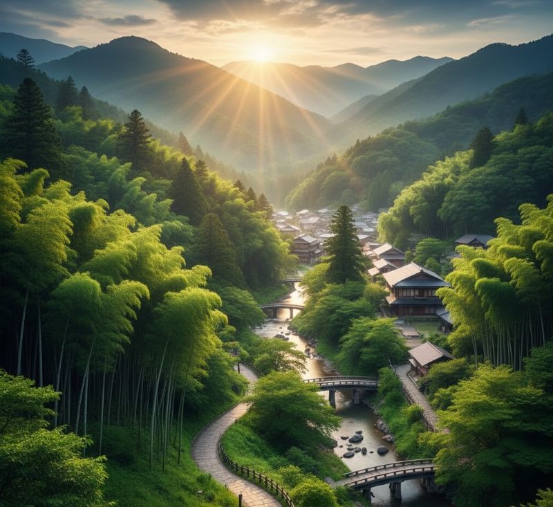
Utah and Arizona: The Red Canyons of Innovation
No landscape captures the imagination quite like the red-rock cathedrals of Utah and Arizona. These regions — home to Arches National Park, Canyonlands, and Antelope Canyon — form the heart of the AI Photography Trek phenomenon.
While NPS-managed areas prohibit drones, vast neighbouring BLM lands near Moab (Utah) allow regulated aerial operations. Here, AI truly comes alive. It overlays FAA airspace grids, BLM permit zones, and real-time weather data, creating a digital flight map that ensures compliance and safety.
Across the border in Arizona, the Navajo Nation’s landscapes — including Monument Valley — hold immense cultural and spiritual significance. AI assists photographers in aligning their schedules with permitted tour times, predicting the arrival of natural light shafts in Antelope Canyon, and respecting tribal boundaries.
This collaboration between tradition and technology amplifies tourism’s positive effects. Local Navajo communities benefit from guided photography tours and permit fees, while visitors enjoy authentic, respectful experiences. AI thus bridges not just the digital divide, but the cultural one — enhancing both preservation and prosperity.
Montana and the Pacific Northwest: Where Data Meets Wilderness
The northern frontier of Montana, Oregon, and Washington remains a paradise for wilderness photographers. In Glacier National Park, AI predicts sunrise reflections on Lake McDonald, models cloud formations over alpine peaks, and guides visitors to safe, scenic ground-based vantage points — all within NPS rules.
Venturing westward, the Pacific Northwest offers greater operational freedom. Expansive USFS and BLM territories across Oregon and Washington permit drone use with approved licensing. Here, AI combines FAA NOTAMs, NOAA weather feeds, and topographical maps to optimise flight plans — ensuring low-risk, low-impact photography.
Tourism boards in these states increasingly recognise AI photography tourism as a driver of eco-conscious travel. It attracts visitors seeking immersive, sustainable experiences, supports rural communities, and diversifies travel economies beyond traditional hotspots.
The Desert Southwest: Death Valley’s AI-Enhanced Exploration
In the scorching expanse of Death Valley National Park, straddling California and Nevada, AI emerges as a crucial safety ally. With temperatures soaring beyond 50°C, drone operations are prohibited under NPS policy, yet AI tools analyse NOAA’s solar radiation and heat index data to pinpoint the safest hours for ground-based shooting or adjacent BLM aerial exploration.
These systems help protect both travellers and fragile ecosystems. Tourism authorities estimate that AI-guided travel planning can reduce environmental strain by up to 25%, underscoring technology’s power to mitigate the impact of mass tourism while maintaining accessibility to one of Earth’s most extreme environments.
The Great Smoky Mountains: Nature’s Intelligent Canvas
In the mist-veiled ridges of the Great Smoky Mountains, spanning Tennessee and North Carolina, AI becomes a poet of precision. With drone use banned, algorithms instead predict fog density, light diffusion, and sunrise timing, enabling photographers to capture the Smokies’ ethereal glow with unparalleled accuracy.
This data-driven artistry nurtures slow tourism — travellers seeking stillness, solitude, and connection over consumption. The result? Enhanced sustainability, deeper appreciation, and meaningful contributions to local economies.
AI, Travel, and the Experience Economy
AI is not replacing travel — it’s redefining it. Across the United States, AI-assisted photography treks are revolutionising how visitors interact with destinations. Instead of rushing from one crowded landmark to another, travellers are now guided by data-driven itineraries that uncover hidden gems, spread visitor flow, and reduce congestion.
This transformation supports a more sustainable tourism economy. Remote regions in Utah, Montana, and Oregon experience increased economic activity, while overburdened parks like Yosemite and Grand Canyon see reduced pressure. AI also cuts carbon footprints by optimising routes and encouraging group expeditions, further aligning exploration with environmental responsibility.
A New Era of Intelligent Exploration
The AI Photography Trek USA signifies more than a technological milestone — it marks the rebirth of exploration itself. In a time when innovation often races ahead of reflection, this movement reclaims the soul of travel by fusing artificial intelligence with authentic experience. It redefines how we perceive the world, not as a digital simulation, but as a living, evolving masterpiece that technology helps us understand more deeply.
From the granite cathedrals of California’s Yosemite Valley to the scarlet sandstone deserts of Arizona, and from Montana’s glacial sanctuaries to the mist-cloaked peaks of Tennessee’s Smoky Mountains, AI’s quiet guidance brings precision to passion. It allows photographers and travellers to witness America’s diverse landscapes with fresh eyes — seeing not only what is before them but what lies beneath the rhythm of light, weather, and time.
This transformation is anchored by the integrity of partnership — between the FAA, National Park Service (NPS), U.S. Forest Service (USFS), Bureau of Land Management (BLM), NOAA, and the Navajo Nation — all uniting technology, law, and culture under a single principle: that discovery must always coexist with respect.
AI, in this sense, becomes less a machine and more a mirror — reflecting back the values we choose to uphold. It does not steal the thrill of adventure; it amplifies it with insight. Each image captured under its guidance becomes a portrait of responsibility, a declaration that travel in the age of intelligence can remain deeply human.
This is not the end of adventure. It is the beginning of a conscious renaissance — one powered by curiosity, sustained by conscience, and illuminated by the luminous intelligence of a new age.
The post California Joins Arizona, North Carolina, Montana, and Utah, driving a Booming AI Travel Trend That’s changing the Face of Tourism in the United States of America appeared first on Travel and Tour World


Comments and Responses
Please login. Only community members can comment.